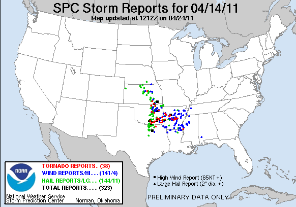
Let's talk about the epic weather outbreak. Thursday, the epic system started off in the Southern Plains. 23 tornado reports occurred that day, including an EF3 tornado which destroyed much of Tushka, OK.
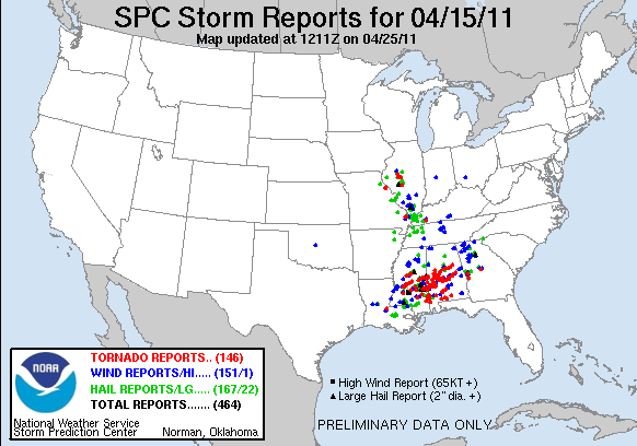
Then on Friday the 15th, the system moved to the deep south. On Thursday, it looked like an epic chase-a-tunity, but the warm front took its sweet time moving north of us. In the morning, I was upset about that, but by about 10 am I was thanking the heavens we were spared from the wrath of this crazy system. Reed Timmer and Chris Chittick took footage of a tornado in Clinton MS just before it went to cause damage in Jackson, MS. This is up there with one of the most amazing tornado videos I have ever seen. I have to include it here! Great work TVN on this video!
Here is a list of the reports for Friday. 113 tornado reports. The above tornado shown in the video was rated EF3, however storm assessments are still continuing!
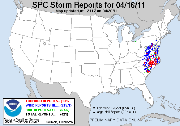
And finally, Saturday.... The system crossed over to the east coast, and a HIGH risk was issued for much of North Carolina. Some of the radar imagery from both Friday AND Saturday was just... wow...
A HUGE tornado headed right for and struck downtown Raleigh. In fact, at one point the tornado was THREE MILES WIDE!!!!
Radar Imagery from the storm that hit downtown Raleigh. Note the debris ball in the BR window.

And now the tornado reports for Saturday... 112 reports which makes for a total of 248 tornado reports in THREE DAYS! All from the same system! Incredible!!!!
It was quite the severe weather weekend, and now another potentially epic event looms on the horizon. SDS cured, but at what price? That is for a future blog post.

No comments:
Post a Comment